FourPoint Mapping
Stroud
ABOUT
Very pleased with this booklet of maps we've created!
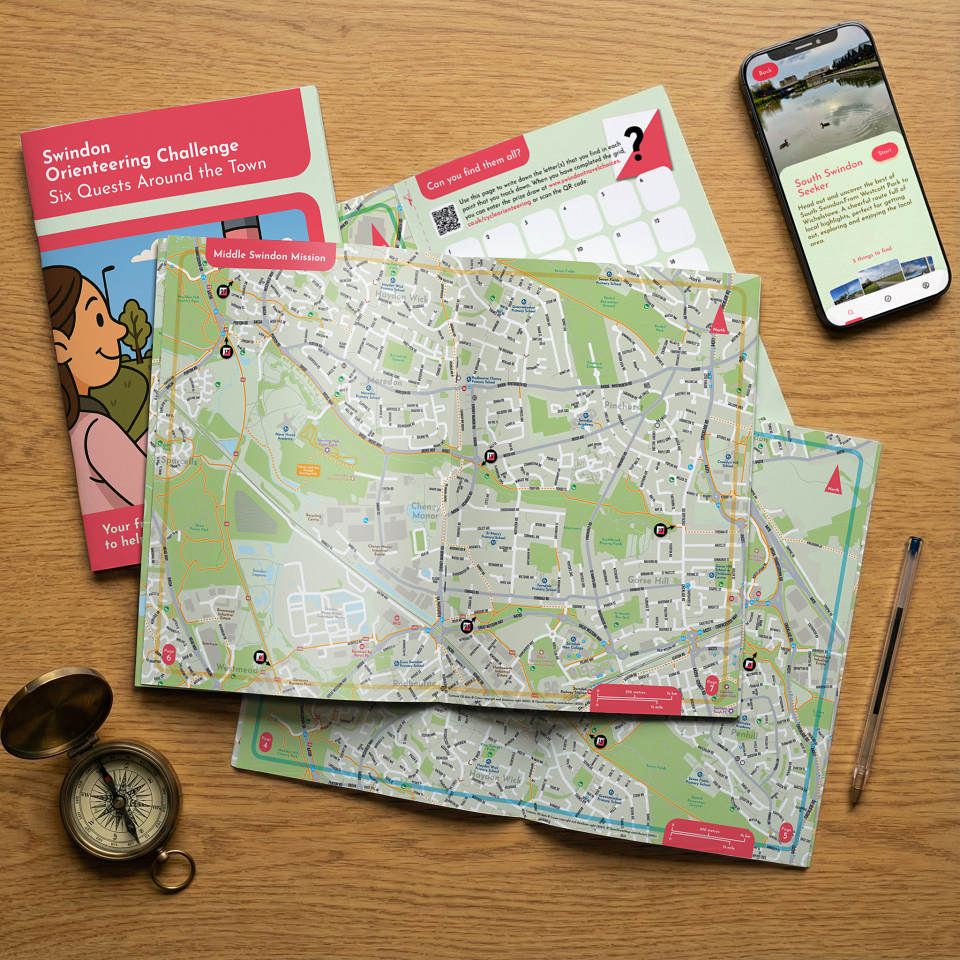
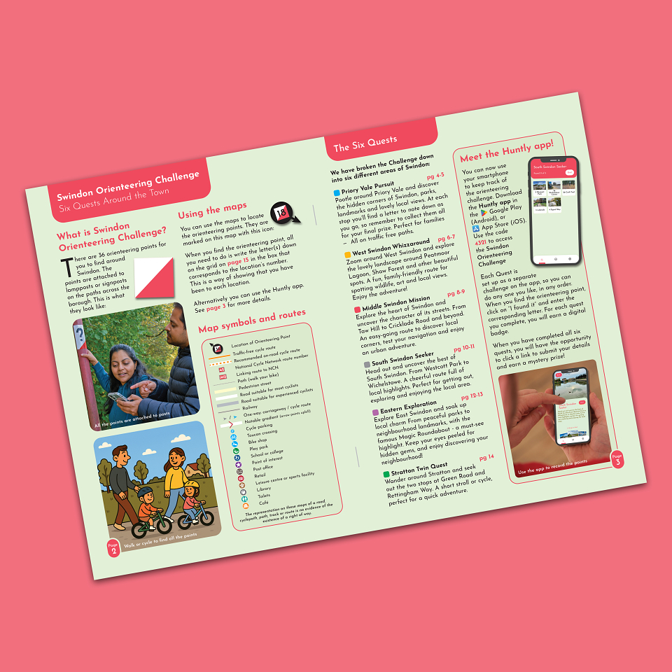
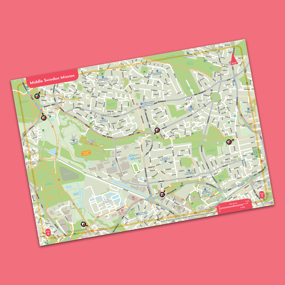
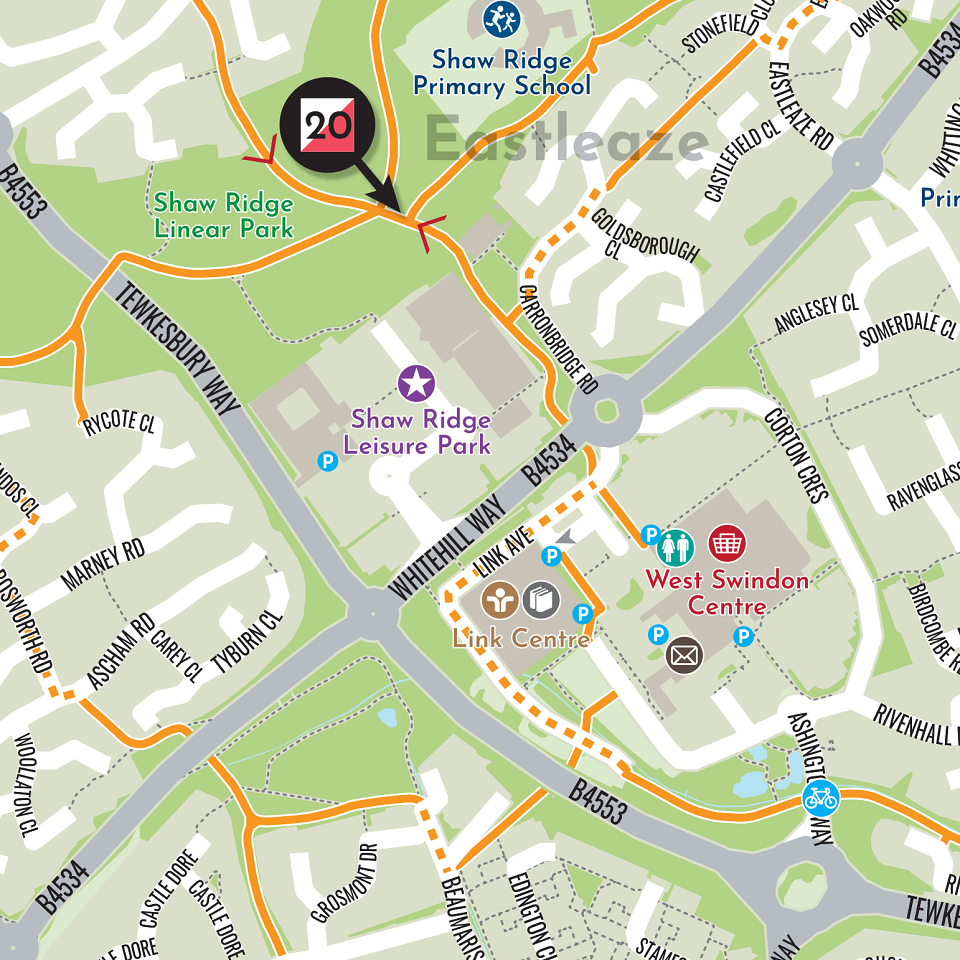
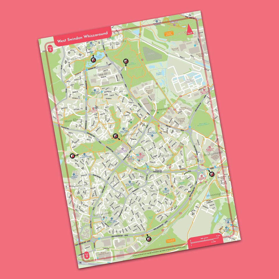
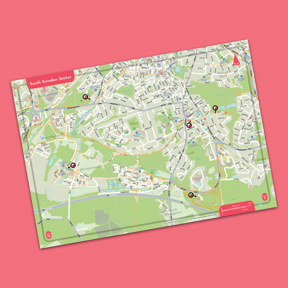
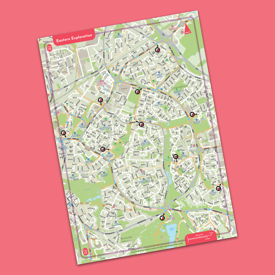
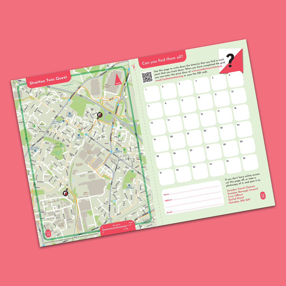
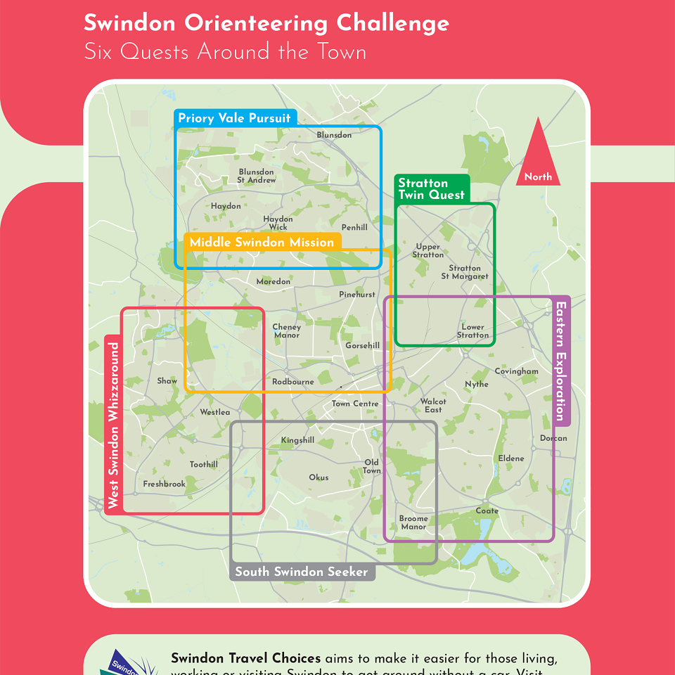
To encourage residents and visitors to explore the town by bike or on foot, Swindon Borough Council has created a series of urban orienteering challenges. Thirty-six ‘control points’ have been placed around the town, each displaying a secret letter that participants must record, either on a paper form or via the accompanying app. Once all the letters have been collected, competitors can enter a prize draw.
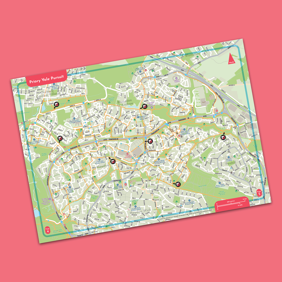
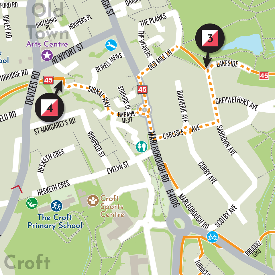
These widely dispersed control points are divided into six more manageable ‘Quests’, each corresponding to a different area of the town. Instead of producing one borough-wide map, we created six individual maps to cover each Quest, and rather than prescribe specific trails, the project encourages users to choose their own routes as they navigate between locations. Five of the maps are at a scale of 1:14,000 and one at 1:16,000, allowing most streets to be clearly labelled. Three of the maps are A4 landscape, two are A4 portrait, and one is A5 portrait.
Instead of presenting the maps and supporting information as a single, conventional, folding large-format sheet, the our client wisely opted for a more distinctive A5 booklet. The format works extremely well: all 16 A5 pages can be printed on a single sheet of A2 paper, making the booklet both economical and convenient to produce. Five-thousand copies are currently being printed and will soon be delivered.