Eric Muchira
Freelance Illustrator & Creative Designer
ABOUT
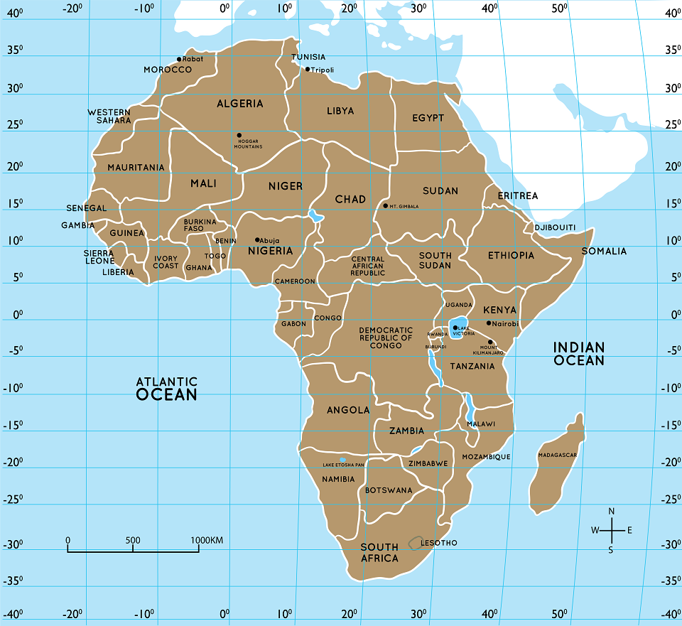
1. A map of African countries with longitudes and latitudes. Indicate the latitude at 40N, 35N, 30N, 25N, 20N, 15N, 10N, 5N, 0 DEGREES, 5S, 10S,15S, 20S, 25S, 30S, 35S AND 40 degrees south. Indicate the longitude at 20W, 10W, ODEGREES, 10E, 20W, 30W, 40W AND 50W. Also on the map indicate lake Victoria, Mt. Gimbala, Ahaggar mountains, Mount Kilimanjaro and lake etosha pan in Namibia Cities: Abuja, Tripoli, Rabat, Nairobi
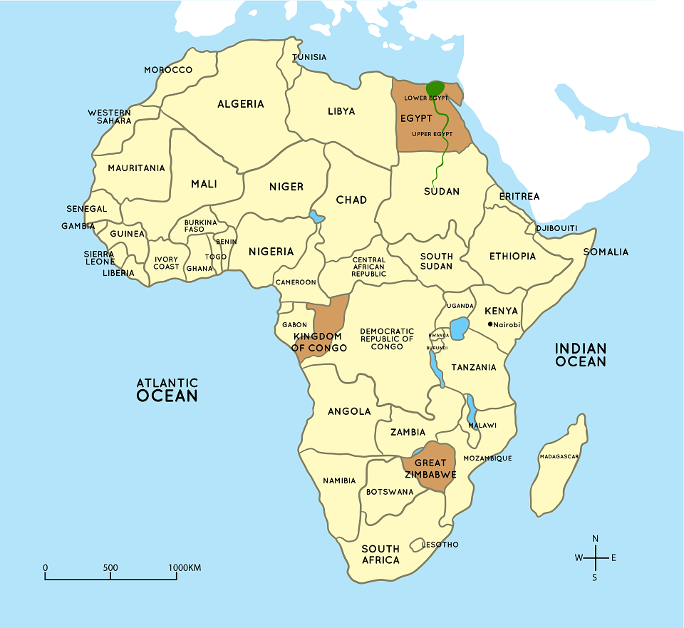
2. Draw the map of Africa and indicate location of ancient Egypt, Great Zimbabwe and Kingdom of Kongo. Ensure that all these areas are on one map of Africa
Ancient Egypt Kingdom of Kongo Great Zimbabwe
Asante Empire Zulu community Ogiek
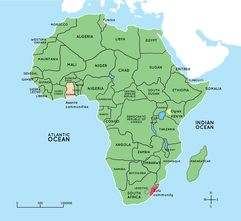
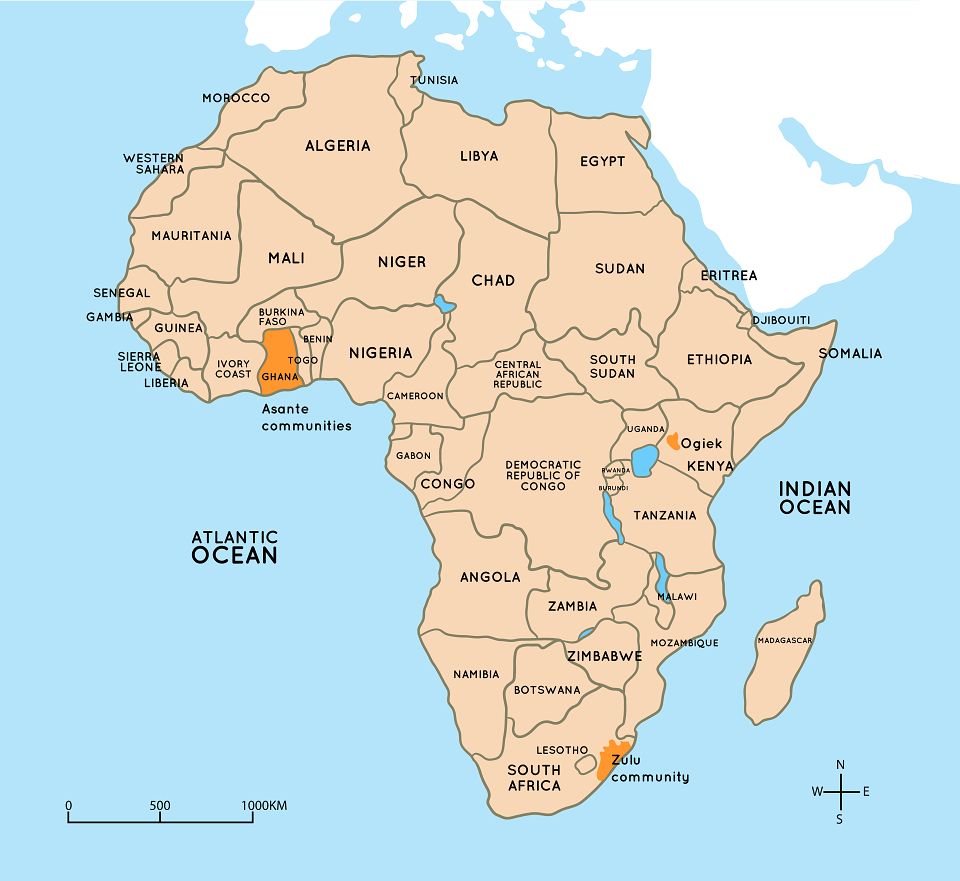
3. Illustration of the map of Africa indicating and showing areas settled by the Ogiek, Zulu and Asante communities in Africa. Ensure that all illustrations are in one map of Africa
4. A map of Africa showing the area occupied by Ogiek, Zulu and Asante
• Most Ogiek live in forested highlands in west central Kenya. The larger Mau Forest is the main example. Its sections extend to Nandi, Kericho, Uasin Gishu and Nakuru counties. Other forested highlands are Tinderet area, Mount Elgon, Nyandarua Mountains, Laikipia Scarp, Karisia Hills, and Cherangani Hills.
• South Africa is the home of most Zulu people. Smaller numbers are also found in Lesotho, Zimbabwe, and Eswatini (former Swazilandi). In South Africa Western Cape Province is heavily populated with members of the Zulu community. It is followed by KwaZulu-Natal, Gauteng, Eastern Cape and Mpumalanga provinces in that order. Smaller numbers of the Zulu also occupy the provinces of Limpopo, Free State, Northern Cape and North West.
• Asante people of south-central Ghana and adjacent areas of Togo and Côte d'Ivoire. Most of the Asante live in a region centred on the city of Kumasi, which was the capital of the former independent Asante states
NOTE: THE TWO MAPS ARE THE SAME BUT ARE TO BE USED IN DIFFERENT SUB STRANDS SO USE DIFFERENT COLOURS TO DISTINGUISH THEM
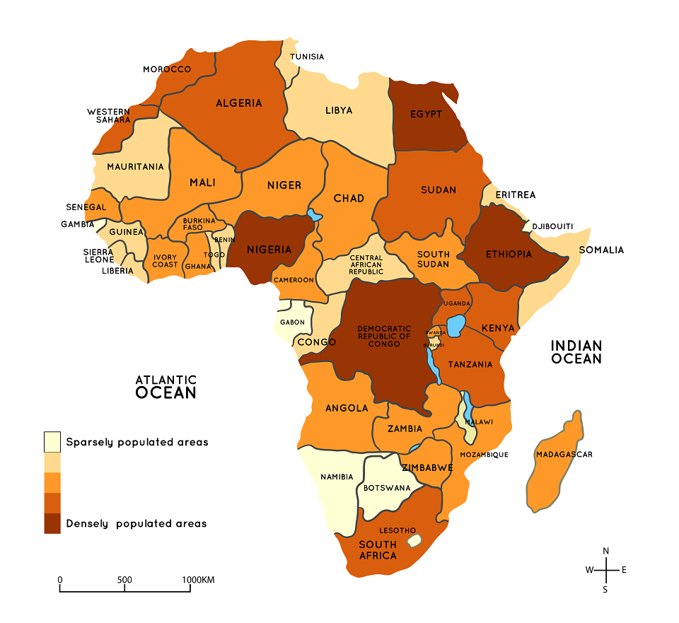
5. A map of Africa showing the population distribution of Africa (densely and sparsely populated areas).
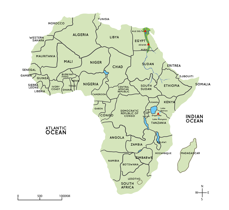
6. A map of Africa showing areas where early agriculture was practiced. Show the following areas on the map: Egypt’s early agricultural area lay along the Nile valley from Aswan in the south to the Nile delta in the south. Nubia was the region between southern Egypt and northern Sudan. Nubia stretched from Aswan in Upper Egypt in the north, at the Nile's First Cataract, to the Republic of Sudan in the south, midway between the Third and Fourth cataracts. The Nile River formed the foundation of early agriculture. In the Rift Valley of Eastern African early agriculture was practiced at Engaruka in northern Tanzania. The location is between Lake Manyara and Lake Natron. River Engaruka provided water for irrigation. NOTE: After drawing the map, creatively indicate to distinguish Nubia, Egypt and Rift Valley of Eastern Africa.
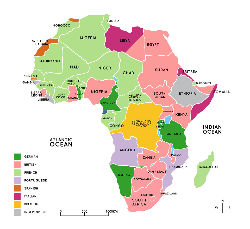
7. Areas in Africa taken up by European countries.
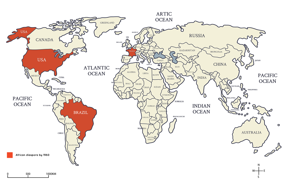
8. Draw a world map indicating countries inhabited by African diaspora by 1960 (USA, Brazil and France)
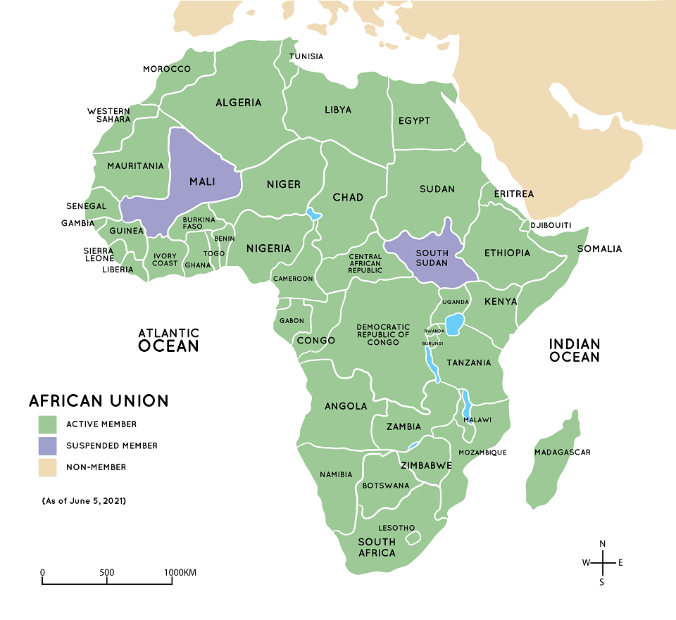
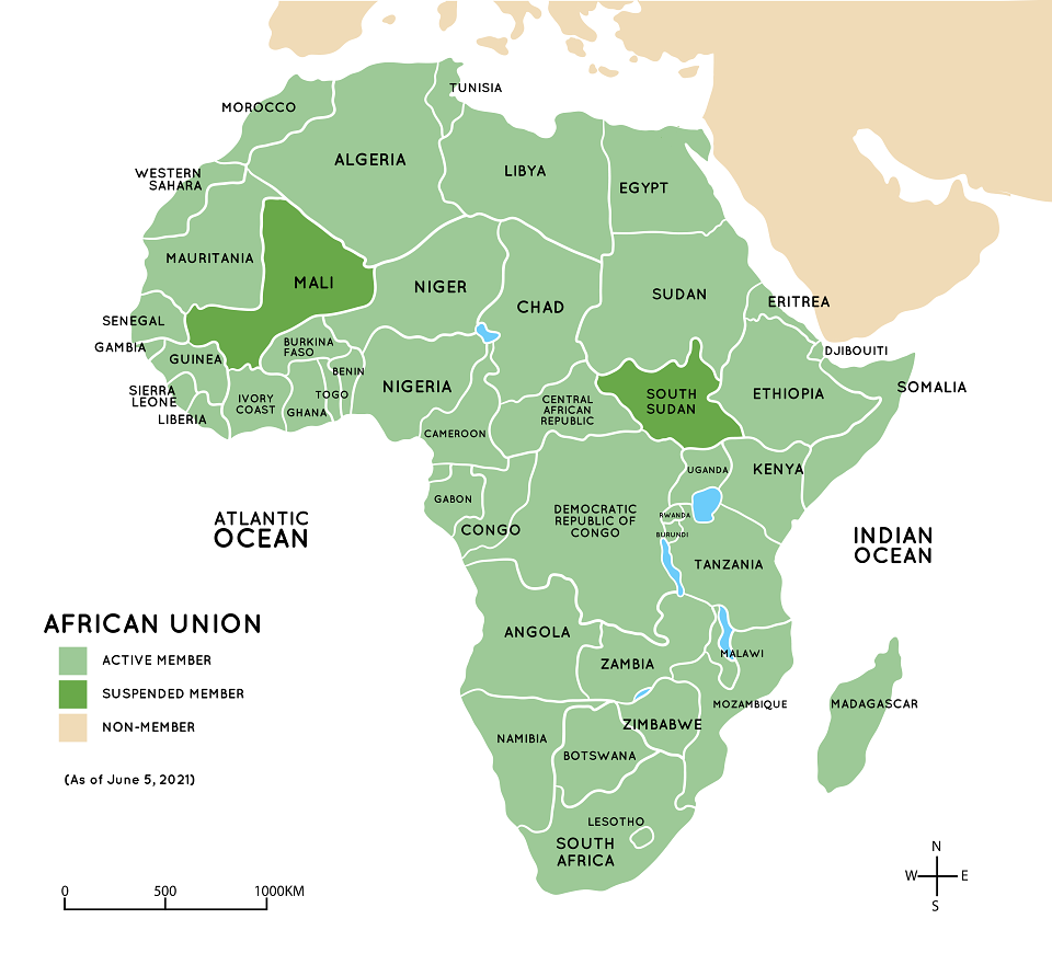
9. A map showing AU member states
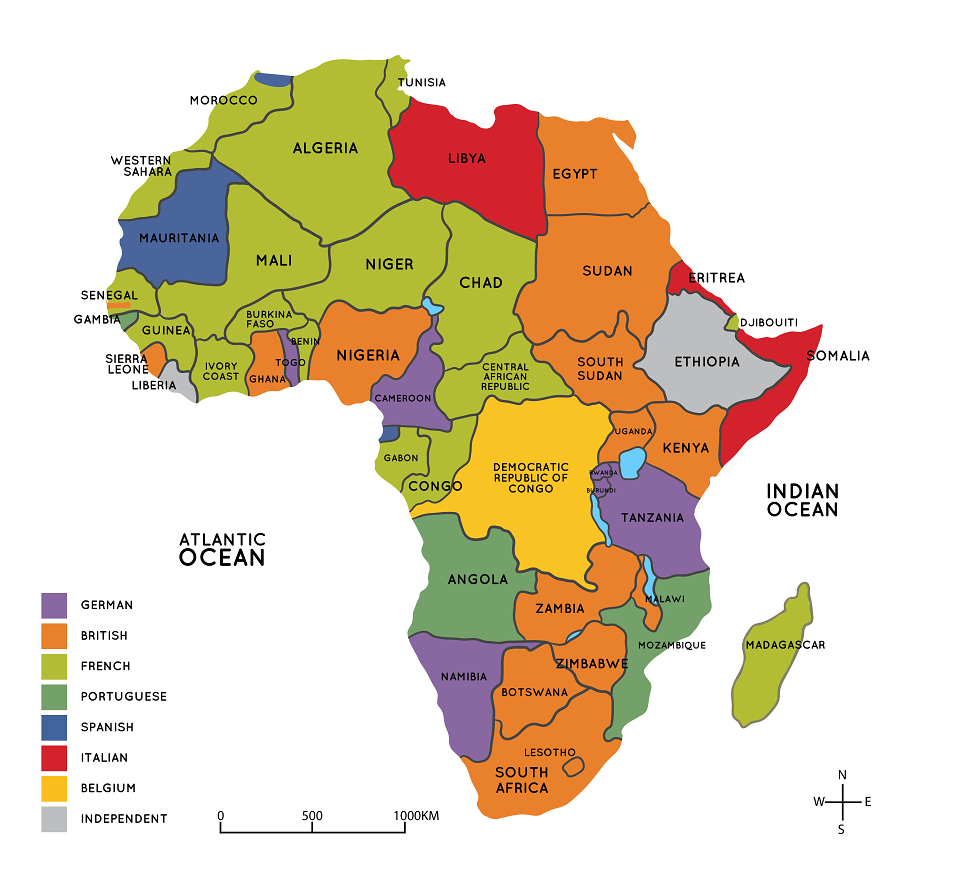
10. A map of African counties and their colonial masters.
11. A map showing all members states of the African Union.
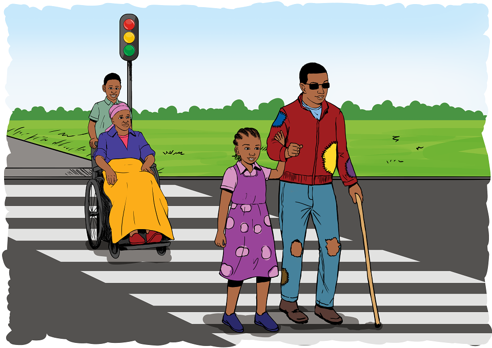
12. Illustration of a girl helping a blind poor man to cross in a zebra crossing also show a boy helping push a lady on wheel chair to cross the zebra crossing.
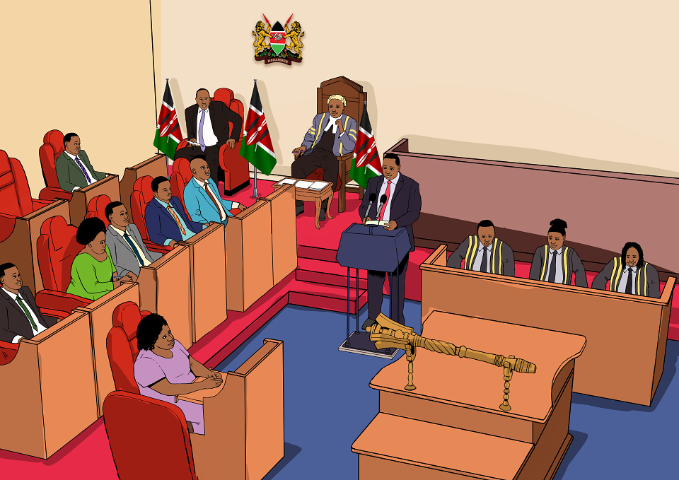
13. Illustration of mps discussing in parliament
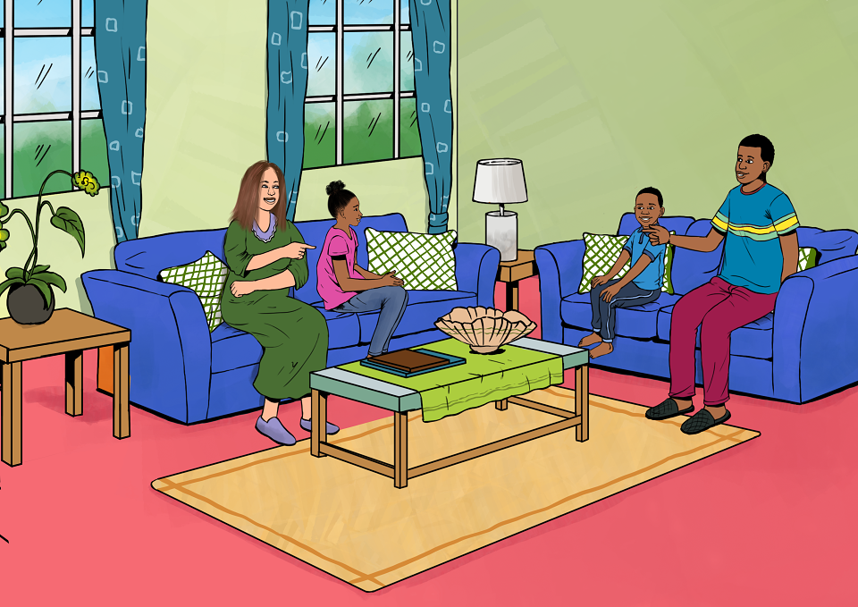
14. Illustration of a Kenyan man with a mzungu wife and two black American kids a boy and girl seated in a sitting room.
MADEIT CREDITS
-

Mountain Top PublishersClient
-

Eric MuchiraFreelance Illustrator & Creative Designer